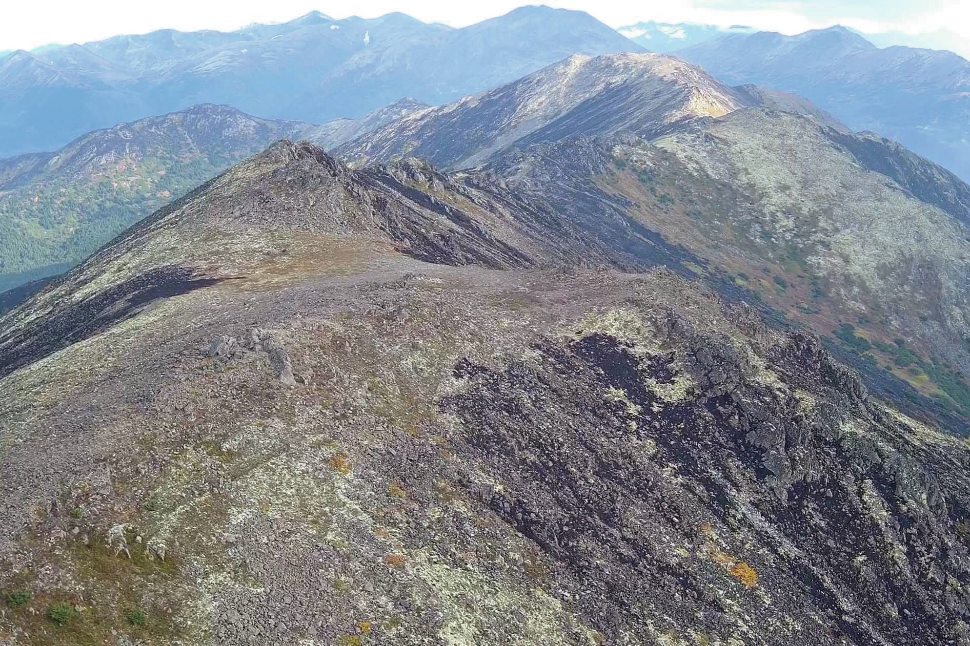
Late last summer, as I waited in a line of traffic on the Sterling Highway to get through the Swan Lake Fire, smoke rose from the slopes of the Mystery Hills around the Skyline Trail.
I love the flower-dotted alpine tundra and commanding views to which that trail provides quick access. Now not only the forest below, but also the dense thickets of green alders above, the lush meadows filled with grasses and fireweed, and the topmost turfy tundra were blackened.
I wondered how this fire would change that landscape.
We on the western Kenai are accustomed to the cycle of wildfire in the boreal forest. From recorded history we have documentation of fires from the present back into the 1800s.
Ed Berg and others, by studying tree cores, buried charcoal and lake sediments, extended this history beyond a thousand years, showing recurrent fires on the Kenai lowlands over that time. Refuge staff have been studying the effects of fire on plants and wildlife since the 1950s, so we have a good understanding of the role of fire in our forests.
We know much less about how subalpine and alpine plant and animal communities respond to wildfire. Fire in the alpine appears to be rare on the Kenai Peninsula. I was able to find reports of only three fires that burned into alpine tundra in the past.
In the fall of 1950, an escaped campfire in the north of the Kenai Mountains grew to become the Big Indian Creek Fire. One map shows the fire reaching into the alpine, but other reports describe the fire as only 3 to 5 acres. At most only a small area of tundra burned.
The Pothole Lake Fire, also an escaped campfire, was called in May 19, 1991. Fire personnel responded aggressively, but by the time it was declared to be contained June 1, the fire had spread to 7,900 acres and it had reached an elevation of 3,000 feet in multiple places in the mountains above Skilak Lake and Lower Russian Lake.
More recently, the 2004 Glacier Creek Fire and the 2014 Funny River Fire each made it to about 2,000 feet high north of Tustumena Lake, just barely getting into shrubs and tundra before season-ending rain events.
To date, no work has been done above tree line on the Kenai Peninsula to learn how plant communities responded to wildfire. The most we can say is that today it is hard to perceive any lasting mark of these fires above tree line by looking at satellite imagery.
These burns have been at least partially repopulated by plants, but we cannot really know how similar these were to the plant communities that existed before the fire.
We do know from tundra wildfires in other parts of Alaska that the response of these plant communities depends on the kinds of plants present, weather conditions at the time of the fire and the depth of soil consumed. Where the soil is moist and the depth of burning is shallow, grasses and sedges tend to come back quickly after fire.
In drier soils where the fire consumes all of the organic material it can take over 100 years for lichens and alpine plants to recover. Above-ground portions of shrubs are often completely consumed in tundra fires, but the shrubs generally resprout from their roots unless the fire burns deeply enough to kill them.
Although no measurements have yet been made of the extent and severity of burning in the tundra in the Swan Lake Fire, it is clear that more alpine area burned in this fire than in all of the previous tundra fires on the Kenai Peninsula since 1950 combined.
We can also see in imagery obtained in September 2019 that the Swan Lake Fire burned in a mosaic pattern in the alpine, leaving patches of green mixed with black. Because soil moisture was extremely low this summer due to historic drought conditions, we expect that the Swan Lake Fire burned deeply into tundra soil in at least some areas.
In the summer of 2020 we plan to visit alpine vegetation plots within the Swan Lake Fire to document burn severity and to begin to measure the recovery (or lack of recovery) of alpine plants.
Partly because the Skyline Trail has long been the easiest access to the alpine on the refuge, researchers have put in a number of vegetation plots over the years for various projects. Now these plots (if we can get to and relocate them) may provide useful information on pre-fire plant communities so that we can compare what comes back after fire.
We even have some data on pre-fire bird and insect communities in the Mystery Hills, so it may be possible to learn how the fire affected them.
The alpine of the Mystery Hills will remain inaccessible to the public in the short term. The Skyline Trail itself was damaged by the fire, with many hazardous snags still standing overhead, retaining structures burned out or weakened, and parts of the trail made more vulnerable to erosion.
It will require extensive work before this trail will be reopened. If you are interested in learning about or commenting on planned trail repairs within the Swan Lake Fire, a public meeting on this topic is being planned for late April.
Matt Bowser serves as Entomologist at Kenai National Wildlife Refuge. Find more Refuge Notebook articles (1999–present) at https://www.fws.gov/refuge/Kenai/community/refuge_notebook.html.
By Matt Bowser
Kenai National Wildlife Refuge


