
It’s all down to what Public Works Director Carey Meyer calls “the icing on the cake” — the final items on the city’s punch list for the 11,000-foot extension of the Homer Spit Trail.
The trail itself was paved earlier this month, just in time for passengers of the first cruise ship, the M/V Silver Shadow, to enjoy the trail extension. Cruise ship head tax money helped pay for the $2.26 million trail improvements.
“Gosh, a lot of the nice stuff is there. The paving. The boardwalk is awesome if anybody remembers what the old boardwalk was like,” Meyer said.
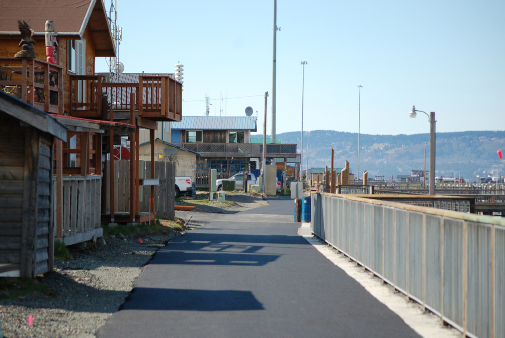
The new trail fulfills a longtime goal of the city: paving the Homer Spit Trail from Kachemak Drive to the end of the road at Land’s End Resort. From the former stopping point at the Pier One Theatre campground near the Nick Dudiak Fishing Lagoon, the trail now runs along the Homer Spit Road to Freight Dock Road, where it runs along the northeast side of the Homer Harbor.
Part of that trail is paved, but near Ramp 3 it becomes a boardwalk to near Fish Dock Road. There the trail becomes paved again all the way to the new End of the Road Park, paved parking by the Pioneer Dock and ferry terminal that includes new public bathrooms. A short trail also runs from Coal Point Park at the mouth of the harbor and along the harbor entrance to Pioneer Dock. Coal Point Park will be the focus of Parks Day celebrations in early August.
A new spur also runs around the harbor by Freight Dock Road and then along the northeast side of the harbor to the Deep Water Dock and the cruise ship staging area.
“I hope we transform the perimeter of the boat harbor that’s welcoming to both visitors and the people who live here,” Meyer said.
Still to be done are amenities like landscaping, signal flags, directional signs, “you are here” location maps and installation of public art. A request for proposals will go out soon for interpretive signs that will include literary art as was done by poet Wendy Erd for the Beluga Slough Trail. Twenty-six nautical signal flags, one for each letter of the alphabet, will go up on posts, with plaques explaining the flags and their associated meanings. V for Victor, for example, a red X, means “I require assistance.”
Also to be hung on the posts will be marine animal themed banners made by NOMAR.
Landscaping will be low maintenance and in keeping with the beach character of the Spit, such as logs, rocks and beach grass.
“What we’re trying to do in the landscape area is create storm berm areas,” Meyer said. The idea is to teach people about the value of driftwood, sand and grass storm berms and not take logs out of it.
With more trail and more access points, Meyer said people won’t have to park at the base of the Spit on Kachemak Drive and can park at lots along the Spit and go several directions.
“I think you’ll see more people driving to the Fishing Hole and using the two more miles to the end,” Meyer said.
The trail will cause changes in traffic patterns. At the Homer City Council meeting on May 12, council member David Lewis said the boardwalk and trail along the harbor will require drivers to be more careful not to block the trail when backing up to harbor ramps and to look out for trail users.
Also still to be done is grading along the trail, striping of the trail and at road crossings, and installation of benches and trash cans.
“By Labor Day the icing is going to be on the cake,” Meyer said. “It’s going to be a different place than it was before — not that is wasn’t a great place before — but now it’s going to be more usable and accessible.”
Michael Armstrong can be reached at michael.armstrong@homernews.com.
