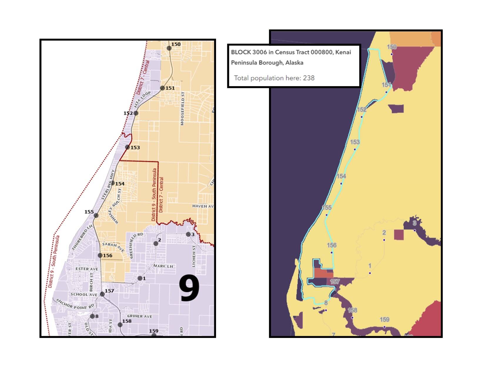
The boundaries of the Kenai Peninsula Borough’s nine legislative districts changed last week following a vote in favor of the move by borough assembly members during their regular meeting in Soldotna.
The affirmative vote marked the end of a lengthy reapportionment and redistricting process that kicked off following the 2020 census. Data collected through that process showed that some parts of the borough were gaining residents more quickly than other parts, and the assembly formally declared the borough to be malapportioned in early 2022.
A reapportionment committee put before borough voters last October the choice of whether or not to retain the current nine-district configuration, or to add two more. Voters ultimately opted to retain nine single–member districts. In order for each resident to be represented as fairly as possible, each district has to have as close to 6,533 people as possible.
Kenai Peninsula Borough Attorney Sean Kelley told the Clarion in January that the need for fair apportionment comes from the equal representation standards of the U.S. Constitution. The Alaska Supreme Court in 1974 said that population deviations of more than 10% are unlawful unless the malapportionment is justified. While that ruling was in relation to a case of state redistricting, Kelley said the case has been cited in local rulings too.
Under the plans approved by assembly members last week, some voters who live in the City of Kenai, for example, are now located in the Nikiski district. That means those voters will elect candidates to the Nikiski seat on the borough assembly and board of education.
The affected section of the Kenai district is east of the Kenai Spur Highway and north of Homestead Loop Road to the northern city limit at Borgen Avenue. Because the borough cannot break up census tracts, an arm along California Avenue juts into the Nikiski district while still being a part of the Kenai district.
Another awkward census tract is part of District 9, or the southern peninsula. That district now includes more residents who live between the Sterling Highway and Cook Inlet north until about Milepost 150 near Katana Drive.
The new district maps were first presented to the borough assembly during a presentation by Borough GIS Specialist Bobbi Sjogren, who said the borough’s goal was to get as close as possible to one person, one vote.
Maps for all districts can be found on the Kenai Peninsula Borough’s website at kpb.legistar.com.
Reach reporter Ashlyn O’Hara at ashlyn.ohara@peninsulaclarion.com.


