(AP) — The board tasked with rewriting Alaska’s legislative boundaries based on the latest census have adopted two draft maps for comment.
During a meeting last Thursday, members of the five-person redistricting board agreed on most boundaries across Alaska but couldn’t agree on the boundary between the Matanuska-Susitna Borough and the Municipality of Anchorage, the Anchorage Daily News reported. Rather than trying to decide the issue immediately, members advanced two different approaches to get comment on.
The state constitution says districts should be “contiguous and compact territory containing as nearly as practicable a relatively integrated socio-economic area.”
Board members disagreed about whether Anchorage and the Matanuska-Susitna Borough are integrated or whether districts should stop at borough boundaries, as they agreed should happen with Fairbanks. For the Fairbanks area, the draft maps placed five seats within borough boundaries, with each district slightly above the target of 18,335 residents per House district.
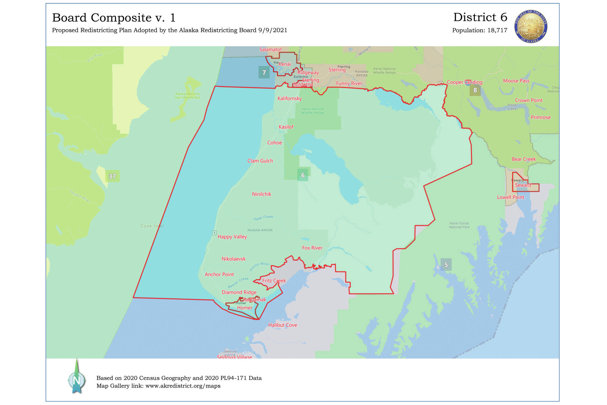
For the Kenai Peninsula, the draft maps move the Funny River area out of what’s now District 31 for the southern Kenai Peninsula and put that in a new District 8. In the Homer area, Fritz Creek and Fox River are moved out of the current District 31, renamed District 6, and into a new District 5 that includes the southern shore of Kachemak Bay and Kodiak Island.
Randy Ruedrich is with Alaskans for Fair and Equitable Redistricting, a Republican-linked group that has participated in redistricting for years. Joelle Hall is with Alaskans for Fair Redistricting, a group supported by labor unions, nonprofits and Alaska Native organizations.
Both called public testimony important because when a final map is considered by the courts, all suggestions are available to the judges. Redistricting plans in past years have faced court challenges.
The redistricting board must approve a final draft by Nov. 10.
Board chair John Binkley said the panel “started with a blank slate based on what the population changes were. And so these are brand new maps for Alaskans to look at. And it really is based on what those population shifts have been in the last 10 years.”
“This is a dynamic process, where it will be evolving and changing as we get input from the public, on what they see in these maps and other people’s opinions,” he said.
Homer News reporter and editor Michael Armstrong contributed to this story.