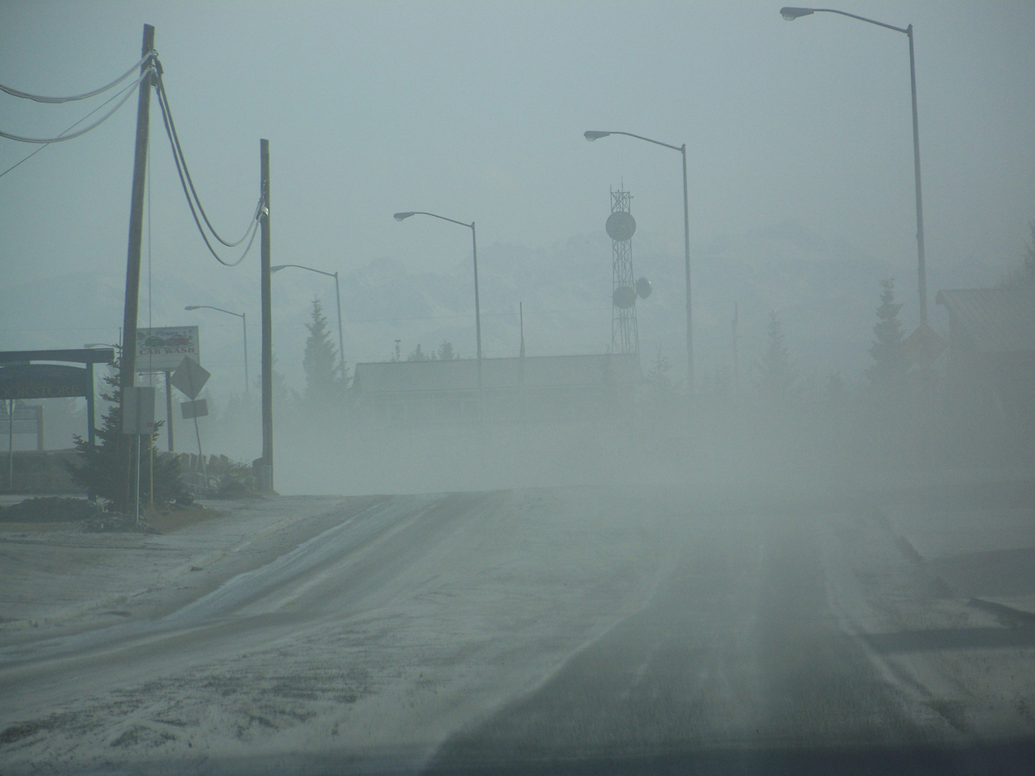
When Redoubt Volcano erupted in 2009, black ash settled on Homer like snowfall.
The city prepared to shut down as the winter sun dimmed.
Stores stockpiled food preparing for the roads to close. Businesses worried ash would destroy air intakes on computers and thousands of dollars in equipment. The city struggled to keep its graders and front-end loaders functioning.
“When the cloud started heading this direction, it was very ominous,” City Manager Walt Wrede said. “It was kind of scary, mostly because of the unknown.”
Homer never shut down, but it braced for it. While forecasters provided good information, more rapid and accurate data would have allowed the city to warn residents and buisness owners what they should expect in losses or how they should prepare, Wrede said.
For more than three years, the U.S. Geological Survey has been working on a solution to Wrede’s concerns. Following the 2010 eruption of Iceland’s Eyjafjallajökull Volcano, costing millions of dollars in several week-long airspace closures, volcano observatories globally began asking themselves what can be done to improve forecasts.
USGS’s answer is Ash3D.
The ash dispersion model will help volcano forecasters more quickly and accurately predict — potentially down to the city — when and what communities will suffer ash fallout and how much they can expect, said John Power, scientist in charge for the Alaska Volcano Observatory.
That is particularly relevant for the Kenai Peninsula, with Augustine, Iliamna, Redoubt and Spurr volcanoes looming in the west. Currently, the four volcanoes are at normal levels of activity.
Ash3D calculates in a cloud how much ash will clump together and, as a result, how far it will travel before it falls from the sky, said Larry Mastin, staff scientist for the Cascades Volcano Observatory. “Right now there’s no other model in the world that considers that process operationally,” Mastin said.
Spain forecasters use a model called Fall3D, but it produces results too slowly to warn communities during the heat of fallout, he said.
Prior to Ash3D, AVO had used a model created at the University of Alaska Fairbanks called Puff. That model produced nearly instantaneous predictions the National Weather Service used to warn cities and airports, but it lacks the comprehensive analysis Ash3D provides.
By determining the aggregation component in the cloud, forecasters also can use Ash3D to predict how much ash remains in the air, crucial information for pilots. Ash shreds plane engines, but in low enough concentrations planes can still fly, Mastin said.
Europe allows for flight in limited-density clouds; the U.S. outright bans flight in areas swept with volcanic ash. Ash3D may change the game for U.S. flight, he said.
With the new model, Mastin also hopes forecasters will be able to more exactly predict areas that the ash clouds will envelope.
When a volcano erupts, forecasters immediately pull up satellite images of the ash plume to determine its location in the sky. They then run the eruption through their models to predict where the ash cloud will blow six to 12 hours following eruption, Mastin said.
The area predicted to be affected is represented on maps as a polygon, and the weather service alerts cities, airports or planes in the marked area, Mastin said.
In the 2010 Iceland eruption forecasters overcompensated when marking the boundaries of the ash cloud’s projected reach. Mastin thinks Ash3D can minimize overcompensation, he said.
Now Mastin and two other scientists — CVO geophysicist Roger Denlinger and AVO geophysicist Hans Schwaiger — are working to integrate a calculus to determine the effects rain, snow and ice will have on an ash cloud. Mastin, Denlinger and Schwaiger have been working together since 2009 on the model.
Already observatories in Iceland, South America, Ecuador and Indonesia forecast ash fallout with Ash3D. AVO and CVO use the model as well, Schwaiger said.
But like all science, the true data is collected in the field. It is verified truth, AVO geologist Kristi Wallace said.
Seth Snedigar and Cheryl Cameron, a website design team at the Alaska Division of Geological and Geophysical Surveys with the University of Alaska Fairbanks, and Wallace have since 2009 been creating another program that will verify Ash3D’s predictions. It’s called “Is Ash Falling.”
The public is a critical component when recording ash fall. AVO has for years called residents of affected areas to collect information. But phone calls to hundreds of people are slow, so now, Wallace and her team are working on a website where residents can log in and report ash fall, Wallace said.
Forecasters can then check Ash3D’s predictions against residents’ reports to refine the model, Wallace said.
“It’s ground-truth knowledge,” she said. “We’re going to immediately see how well the model predicted what’s happening.”
Currently, Mastin, Denlinger and Schwaiger are fine-tuning Ash3D. The team is creating an online interface for other forecasters to more easily use the model — an important feature, Denlinger said, as the U.S. Volcano Disaster Assistance Program told the team this year that the model will be used worldwide.
The team plans to finalize Ash3D with the launching of a new satellite in 2015. The satellite will be equipped with infrared sensors that can, every 15 minutes, calculate an ash cloud’s density, Mastin said.
“Hopefully (Ash3D) will help us, and the emergency managers, do a better job responding to those interruptions of life in Southcentral Alaska,” Power said.
For Wrede, that would be a relief. Homer prepared extensively for Redoubt Volcano’s eruption four years ago, but they just didn’t know exactly what to expect when that ominous cloud slid over the city, Wrede said.
“It was a wake-up call for us,” he said, “and we were pretty close to activating our emergency operation center.”
Dan Schwartz can be reached at daniel.schwartz@peninsulaclarion.com.


