
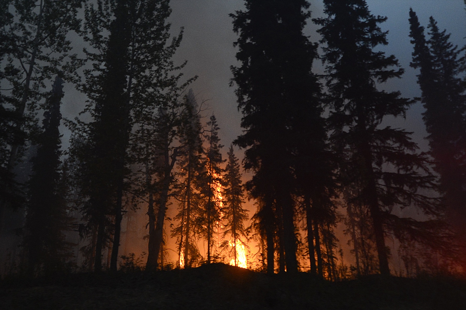
High, dry winds from the southwest could increase activity on the Funny River Horse Trail fire Friday afternoon. In a press release this morning, the Alaska Interagency Incident Management Type 2 Team now calculates the size of the fire as about 67,000 acres, still within the Kenai National Wildlife Refuge south of Soldotna and east of Kasilof. A team of 374 firefighters, including crews from the Lower 48, have contained 15 percent of the fire on the northeast flank near Funny River Road.
Here is the latest:
• The Funny River fire is 67,084 acres;
• It is 15 percent contained on the northeast flank;
• As of 4 p.m. Thursday, the fire was 3.5 miles from the Kasilof River, 3 miles east of the Pollard Subdivision near Kasilof, and less than 2 miles from the Bear Creek Subdivision on Tustumena Lake; and
• 374 people are working the fire, with helicopters with water buckets and four water-scooping aircraft dumping water on the fire. A crew from Oregon is assisting smokejumpers to protect cabins at the Bear Creek subdivision.
Winds blowing to the northeast could change the dynamic of the fire. Until now, winds have generally blown to the southwest, sending smoke toward Homer and the lower Kenai Peninsula and pushing the fire into the refuge and away from most settled areas. On Friday morning, an inversion layer kept Homer and the bay covered in haze.
The National Weather Service issued a red-flag warning this morning. It remains in effect until 10 p.m. today for the western Kenai Peninsula and Susitna Valley. A red flag warning is issued when “critical fire weather conditions are imminent or occurring now … or will shortly. It is directed toward fire agencies … and through them to the public,” the NWS says on its website.
Officials urge people on the holiday weekend to use extreme caution with fires. A burn ban suspension is in effect for the Kenai Peninsula, including burn barrels. Campfires no larger than 3-feet wide are allowed in fire rings on bare soil, with no combustible material, including driftwood, within 10 feet. Buckets of water should be on hand to put out the fire.
One bright spot in the forecast is that southwest winds should blow smoke away from Homer. That’s bad news for the central peninsula, however, as those winds also could shift the fire toward Soldotna and Kasilof.
Firefighters had prepared for that contingency, though, and expected winds would eventually turn, said Brad Nelson, a public information officer for the Kenai Peninsula Borough Office of Emergency Management. Crews have been concentrating efforts on the northwest corner closest to Soldotna, building firebreaks.
“They’ve been preparing for that for some time,” Nelson said. “The weather’s coming and they’re ahead of the game on that. When those winds come, it’s not going to be a surprise.”
Activity on the fire has increased, Nelson said.
“They’re making some attacks and some progress on this fire,” he said. “The tide has turned.”
Smoke has affected Southcentral Alaska all the way to the Matanuska-Susitna Borough. The area is expected to get a respite next week, with rain predicted for Tuesday.
The National Weather Service forecasts areas of smoke for all of Southcentral Alaska with clouds, high temperatures into the 60s and winds around 10 mph. Smoke also will make its way to the Western Prince William Sound and Seward by tonight. Temperatures in that area are forecast to hit the 60s, with winds 10-25 mph during the weekend. Concentrations of smoke can be affected by wind patterns, cold-air inversions in the late evening and early morning, and the wildfire itself.
On Thursday, the Alaska Department of Environmental Conservation and the Department of Health and Human Services issued air-quality advisories for all of Southcentral Alaska. For Anchorage and Kenai, the advisory is in effect until next Tuesday, with air quality varying between good and unhealthy. In the Matanuska-Susistna Borough, air quality is unhealthy to hazardous until current fires are out.
“Unhealthy” means that people with respiratory or heart diseases, children and the elderly should avoid any outdoor activity. Everyone else should avoid prolonged exertion. Air quality can be estimated by looking at visibility. If visibility is 1.5-2.5 miles, air quality is unhealthy. If .9 to 1.4 miles, air quality is very unhealthy. If .8 miles or less, air quality is hazardous. Visibility in Homer was about 3 to 5 miles, with the south side of Kachemak Bay obscured in haze.
A chance of rain appears in the forecast for Tuesday through Thursday, with temperatures reaching up into the 60s and lows in the 30s and 40s.
Officials urged travelers to drive carefully along the Sterling Highway, particularly in the Soldotna and Kasilof areas. Use headlights and be aware of emergency equipment in the area, including aircraft. Do not block roads to view the fire. Nelson said a fire information center has been set up at a pullout near Mile 106 Sterling Highway between Soldotna and Kasilof, with an information officer on hand.
No evacuation orders have been issued, but Nelson of the borough encouraged homeowners in the areas closest to the fire to prepare. That means getting homes firewise by clearing brush and firewood away from homes and making plans. Gather together clothing, medication and other supplies. Know where to go in case of an evacuation and make sure someone knows your plans.
Landline phones are already set up for automated telephone notifications, but residents also can register cell phones by going to the borough website at http://www.borough.kenai.ak.us/emergency-mgmt.
The weather forecast for Homer is as follows:
Today: sunny, areas of smoke, highs in the upper 50s to mid 60s except in the upper 60s inland, variable wind to 10 miles per hour, inlet breezes to 15 mph in the afternoon;
Tonight: partly cloudy, areas of smoke, lows in the upper 30s to mid 40s, variable wind to 10 mph, inlet breezes to 15 mph in the evening;
Saturday: partly cloudy, areas of smoke, highs in the upper 50s to mid 60s, light winds becoming southwest 10 to 20 mph with gusts to 30 mph in the afternoon, strongest along the inlet;
Saturday night: partly cloudy, areas of smoke, lows in the upper 30s to mid 40s, south wind 10 to 20 mph with gusts to 30 mph, strongest along the inlet;
Sunday: partly cloudy, areas of smoke, highs in the mid 50s to lower 60s, southwest wind 10 to 20 mph;
Sunday night: partly cloudy, lows in the 40s;
Memorial Day: partly cloudy, highs in the 60s;
Monday night: mostly cloudy, lows 35 to 45.
Important websites:
Homer Harbor web cam:
http://www.homeralaska.org/chamber/homer-harbor-webcam
Department of Environmental Conservation air quality alerts and information:
http://dec.alaska.gov/Applications/Air/airtoolsweb/Advisories
National Weather Service Alaska Region:
Information on Funny River fire:
http://inciweb.nwcg.gov/incident/3878
Alaska Interagency Coordination Center
http://fire.ak.blm.gov/aicc.php
Click on “fire information” in menu to the left to get a map of all fires in Alaska. Zoom in to see the Funny River fire.
Kenai Peninsula Borough Office of Emergency Management:
907-714-2495
http://www.borough.kenai.ak.us/emergency-mgmt/fire
Road condition reports
McKibben Jackinsky can be reached at mckibben.jackinsky@homernews.com. Michael Armstrong can be reached at michael.armstrong@homernews.com.
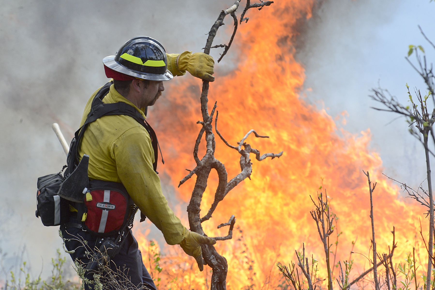
Crews backburned portions of the Kenai National Wildlife Refuge Wednesday May 21, in order to keep the Funny River fire from burning across Funny River Road in Funny River, Alaska. -Photo by Rashah McChesney, Morris News Service
