

Editor’s note: This is the sixth story in the Morris Communications series “The case for conserving the Kenai king salmon.”
In the continuing saga of Kenai River king salmon management during the current period of low abundance, counting the number of fish coming into the river with enough accuracy to satisfy competing users has been a difficult task for the Alaska Department of Fish and Game.
Researchers are dealing with new, high-tech sonar counters they hope will meet the inherent challenge of finding and counting a few king salmon swimming along with thousands of sockeye salmon.
They also are faced with the task of communicating the subtleties of an increasingly complex system to a public upset by departmental missteps such as the 2012 closure of king salmon anglers and Cook Inlet setnetters due to what managers believed were dangerously low numbers of fish.
In the postseason analysis, ADFG revised its estimates upward to show more than 25,000 king salmon having made it into the river. That was greater than the minimum escapement goal of 17,800, and shouldn’t have led to the complete closures ordered by the department that led to an economic disaster being declared by the U.S. Secretary of Commerce.
The ADFG Division of Sport Fish sonar program has been slow to spread across the state, but there are few places where using sonar to count fish has been explored as thoroughly as it has been on the Kenai River.
Developing the sonar program
The Kenai River was the first place where managers used sonar in a river to count fish, said Debby Burwen, a fisheries biologist who has been with the Kenai River chinook salmon sonar project since 1986.
The first project was the sockeye sonar counter at river mile 19.
The project began with dual beam sonar, which could estimate the size of a target but could not tell which direction the object was travelling.
From there it evolved to using split beam sonar, which could track a target as it traveled though the beam, using the three-dimensional position of the target to theoretically distinguish a king salmon from a smaller sockeye, and help managers keep from counting the same fish multiple times.
Split beam sonar has since given way to the dual frequency identification sonar, or DIDSON, which gives managers an actual image — much like an ultrasound — and allows for a better estimation of fish size to differentiate between species. The newest sonar iteration, the ARIS, or Adaptive Resolution Imaging Sonar, imaging technology, provides higher resolution and more easily trackable images of each fish.
The DIDSON counter was tested for three years from 2009-11 alongside the split-beam sonar to compare results before fully converting to it for the 2012 season.
“It has been so interesting,” Burwen wrote in an email. “This is because we were always able to test and then use the newest acoustic technologies as they were made commercially available.”
At the beginning, the technology was as experimental as the ways the managers used to make it work.
The first year Burwen was with the program, managers were attempting to cope with the water level variation brought on by the tides at the lower river sonar site by putting the sonar on a railroad track.
“As the tide came up and went down we would roll the sonar out on this railroad track, it was mounted on a cart. We tried to make the car go up and down with the tide, that was just an incredible ordeal because debris was always getting on the track,” Burwen said. “Finally, we realized that you just couldn’t do that.”
That was the year, Burwen said, managers discovered why they weren’t seeing any fish.
“The fish are bottom oriented at least much of the time and even one degree off, you’d lose all of your fish,” she said.
The newer sonar technology is not as difficult to aim as its predecessors, Burwen said.
Still, the technology has its drawbacks.
One of the primary barriers to a wider use of sonar to assess salmon runs — just 16 rivers in Alaska were using the program by 2013 — is the difficulty in discriminating between fish species, according to a 2007 ADFG study evaluating the use of sonar.
Of those 16, the Kenai, Nushagak and Yukon rivers were the only ones where managers were using the technology to count king salmon.
Burwen said most managers in Alaska were using the DIDSON for in-river counting, but in large rivers like the Yukon where the range of river that must be viewed exceeds the DIDSON’s range, split-sonar is still used.
Lower River
Currently, ADFG uses a king salmon sonar site located at river mile 8.6 of the Kenai River to estimate abundance and manage the early and late runs of king salmon.
There, managers sit in a tent on the north bank of the river, where the riverbed is even enough that managers could ensonify — or see — the middle portion of the river.
Being able to see that portion of the river is crucial because according to ADFG data king salmon — though they can be found in all portions of the water column — tend to swim upstream in the deeper portions of the river.
For 10 minutes of each hour, the sonar measures a portion of the river. Researchers then view the sample and count the number and length of king salmon swimming through at the time of the sampling.
Watching all of the footage can be overwhelming, said Brandon Key, ADFG fisheries biologist and sonar analyst.
“Every hour there’s 80 minutes of data that we have to go through,” he said.
The data is complex.
“It’s hard to get through if you don’t have experienced people on it,” Key said. “As long as somebody is looking over their shoulders you can have untrained people doing it, but it takes some time.”
Even trained king salmon counters can make mistakes, and there are several counting rules in place to ensure fish do not get counted twice.
“Everyone’s double-checking their kings,” Key said.
Despite the length of time ADFG researchers have spent using the lower river site for management, it has several disadvantages including being subject to tidal influence, interference from silt and floating debris and milling fish behavior, according to ADFG data.
Another disadvantage is that the sonar sits in the river in such a way that it is missing king salmon that swim behind the counter.
During the 2013 season, staff netted near the shore behind the lower sonar and found kings.
“The ones that we caught in our netting were generally quite a bit smaller and younger than the ones we caught offshore,” said Tim McKinley, biologist and research supervisor for the Division of Sport Fish Soldotna area office.
A new site, one at river mile 13.7 has been in development since managers went looking for a new site in 2011.
Upper River research
Managers seeking to differentiate between it and the lower river site currently used for in-season management have dubbed the ADFG upriver sonar site at mile 13.7 as a “research project.”
The new site has several features favored by managers, including bank-to-bank coverage of the river, McKinley said.
Researchers use five ARIS, essentially the next generation of DIDSON, to collect data on at the upriver site, compared to the two used to collect data at the lower river site.
During the 2013 season — the first during which the upriver sonar array system was run for the entirety of the season — analysts waited until August to process data.
Researchers must watch two hours of footage for every hour that passes at the upriver site.
During an August tour of the two sites, researcher Jim Miller told the group that because the lower river was used for management while the units upriver were still experimental, the department did not prioritize interpreting data generated from the new site. Still, the sonar staff has finished processing data from the lower river and upper river sites since the last week of October, Burwen said in an interview during that week.
Burwen clarified that processing meant the sonar analysis crew had done the minimal amount of work reviewing data and measuring fish.
“It can be very time consuming, but is necessary to do, especially with a brand new technology like the ARIS,” she wrote in an email.
At the time, Burwen said managers were planning to give a preliminary report well in advance of the Upper Cook Inlet Board of Fisheries meeting scheduled to begin in late January.
She was hesitant to release data at the time, she said, as analysts were not yet sure how to compare data between the two sonar sites and did not want to merge the two incorrectly.
ADFG sonar analyst Key said comparing numbers from the two sites was like comparing oranges and bananas.
“They’re just numbers,” he said. “Just because you get a larger number here doesn’t mean it’s not the same number, they’re just different systems.”
Despite repeated requests — both by the media and members of the public — for 2013 data from the upper river research site, a final estimate of king salmon passage has not been released.
Key, Steve Fleischman and others within the department say the data has been processed, however Southcentral Region supervisor Jim Hasbrouck said the 2013 season analysis is not yet ready for the public.
Fleischman, a fisheries scientist in the ADFG statewide research and technical services office, said he and others were tasked with the postseason analysis.
“I think we’ve pretty much done as much postseason scrutiny of the numbers as we’re going to and there were some surprises in there, but for the most part it kind of makes sense,” he said.
Fleischman declined to comment further on surprises with the data from the new sonar site as, he said, it was not his decision to release the information.
“The thing is, that whenever you do something new — and especially when you have a tool that you have a lot of confidence in — sometimes you learn things that you didn’t expect and so it’s been very interesting,” he said. “It’s one thing to plan a new project at a different place on the river and work out all the logistical details of being able to count all the fish or virtually all the fish, but it’s another thing entirely to get the data back and then really try to understand all the processes. You always get something unexpected.”
Fleischman deferred further questions to Hasbrouck, who said the department was not yet ready to discuss its postseason analysis of 2013 data.
“We need more thorough vetting of the data and the trends and what they may mean,” Hasbrouck said.
Several meetings are scheduled for the first part of December, Hasbrouck said.
Those meetings are with “higher ups,” he said, not the biologists and fisheries scientists who had already interpreted the data. Needing to run the data through higher-level ADFG management did not mean there is politics factoring into the how the department interpreted the new data, he added.
Rather, the meetings were to determine a uniform ADFG interpretation of the new sonar data, he said.
“It’s not like this means that the interpretation is going to change,” Hasbrouck said. “There are just other people that are part of the discussion.”
The drawbacks
One of several logistical issues in managing the sonar sites is the amount of data generated by the DIDSON and ARIS sonar arrays.
Between the two DIDSONs and the five ARIS units at the upriver site on the Kenai River, about 250 gigabytes of data were generated each day. That adds up to about 24, 576 gigabytes — or nearly 25 terabytes — of data collected in 2013.
“Data and file management is a big part of our project development,” Burwen wrote in an email. “I’m happy to say we have the data flow worked out at both sites and both projects operate very smoothly with respect to data management.”
Also at issue is the continuation of some of the research projects ADFG uses to check the accuracy of its sonar data.
One of the projects is a netting program that apportions the ages of fish in the king salmon run counted by the sonar. King salmon return to spawning grounds between ages 4 and 7, and the project applies the age proportion of fish caught in the nets to the numbers of fish counted by the sonar. That netting project would be difficult to continue at the upriver sonar site, according to Burwen.
Burwen said running a netting project at river mile 19 during the 1990s on the Kenai River had proven difficult for researchers.
“We had an expert crew and it was very dicey, they had to be ready. When a net hangs up on a boulder it’s a lot different than when it hangs up downstream, you can’t be hung up in a fast current on something that’s stationary that’s attached to your stern,” Burwen said. “Evaluating safety is one thing that goes into it.”
Beyond safety, running a netting program near the upriver sonar would require managers to drift a net on a portion of the river that is typically crowded with sport anglers during the king fishing season.
McKinley, the Soldotna area research supervisor, said the net apportioned estimate was an important tool for managers for the information it generated about the return
per spawner for a specific year — or how many fish made it back into the river from a parent generation.
“That is, by and large, how we set our escapement goals,” McKinley said. “This number of fish (spawners) produced this many (returners).”
Continuing the netting program lower in the river and applying the proportion to the upriver site would not work, McKinley said, because the current netting program covers just a portion of the river while the upriver research site covers the entire river.
“We really feel this upper site is going to work,” he said.
In an earlier interview, McKinley said the net-apportionment would probably be phased out, however in a later interview he said ADFG would “probably continue our netting at about the same location, but be doing it differently.”
Former area research biologist Ken Tarbox said king salmon managers could be focusing too much attention on the minutiae of counting the king salmon.
Tarbox — who worked closely with the sonar on the Kenai River used to count sockeye salmon — said there was a nearly 20-year lag between when ADFG started using sonar technology in Cook Inlet and when it became a management tool for king salmon.
“So, from 1985 to the present the focus has been on developing a technique to count chinook, “ Tarbox said. “The managers (are) still looking for those magic numbers that they have confidence in and are reliable … the drive to get reliable counts has been driving the research dollars.”
The desire to count the number of king salmon coming into the river, however, could be replacing other types of research that also can be used to manage the king salmon run.
“If you don’t focus also on habitat issues and life history information, when you get a downturn in production, you’re sitting there not knowing what’s happening,” Tarbox said.
Confidence in the data
While McKinley and others in the department expressed confidence in the upriver site and both the DIDSON and ARIS as accurate counting tools, longtime fishermen and former ADFG biologists have called into question the accuracy of the data coming out of the new sonar.
Several commercial and sport fishers questioned the accuracy of sonar data showing 2,038 early run Kenai River king salmon swimming past the counter in 2013.
Early run king salmon are known to spawn primarily in tributaries of the Kenai River including the Killey and Funny rivers where U.S. Fish and Wildlife Service currently operate weirs to estimate the number of fish in the river.
Typically, between 48 percent to 58 percent of the early run spawns in the Killey river, 24 percent to 37 percent spawns in the main stem of the Kenai and 11 percent to 12 percent spawns in the Funny River according to Fish and Wildlife Service data.
Ken Gates, a USFWS biologist in Kenai, wrote that draft data from the 2013 season showed 1,881 kings swimming up the Killey and 1,027 swimming up Funny River.
If the typical proportions of the early run of king salmon were to be applied, indications are that the Kenai River early run of king salmon could have been larger than what was counted by the DIDSON.
Some anglers also are concerned about the amount of sport fishing effort that happens below the ADFG upriver sonar site and how that could affect estimates of the run.
Dwight Kramer, private angler and head of the Kenai Area Fisherman’s Coalition, wrote in an email that he also was concerned that the department would rely on the sonar for in-season management without determining what effect downstream harvest could have on the run.
“It would seem to me that they would have to be very conservative until they have the numbers to liberalize the fishery otherwise they will risk over-exploiting the run and not enumerating enough spawners,” he wrote. “I am anxious to hear their plan for this dilemma.”
Looking ahead
While questions about how long funding will remain in place to allow ADFG managers to continue comparing and utilizing lower river and upper river sonar counts, managers are still excited to continue using the sonar in the coming years.
McKinley said having bank-to-bank coverage of the river was a boon, as well as the new upriver site being easily accessible from the road system.
“We’ll be directly estimating what’s there instead of using inferences to estimate what is behind the sonar,” he said. “I’m absolutely looking forward to it.”
Key said one new area of research planned by the sonar crew for the 2014 season was figuring out where king salmon swim in the water column.
“The idea is that since the water is moving so fast the fish stay closer to the bottom,” he said. “We’ve got a few days scheduled for next year to see if there are more higher in the water column.”
ADFG has not yet announced when it will fully transition to the upriver site for inseason management, but McKinley said the best-case scenario would be that managers are given at least three years to compare data between the two sites. “If they compared well, it just wouldn’t be cost effective to keep running both,” he said.
During the 2013 season, ADFG staff also gave tours to several groups interested in finding out about the sonar program.
Key said the increased openness was encouraging.
“I certainly wouldn’t mind a little more community outreach,” Key said. “I’ve been on the other side of that as a fisherman and it’s the same kind of deal, it’s just really what people want is more communication.”
Next week: An interview with Gov. Sean Parnell and ADFG Commissioner Cora Campbell.
Rashah McChesney can be reached at rashah.mcchesney@peninsulaclarion.com. Comments on the series can also be sent to kenaikings@morris.com.
Alaska Department of Fish and Game fisheries biologist Larry Wheat counts red salmon recorded by a DIDSON camera from a perch inside a small cabin alongside the Kasilof River. The department is using the sonar to keep track of escapement goals.-Peninsula Clarion file photo
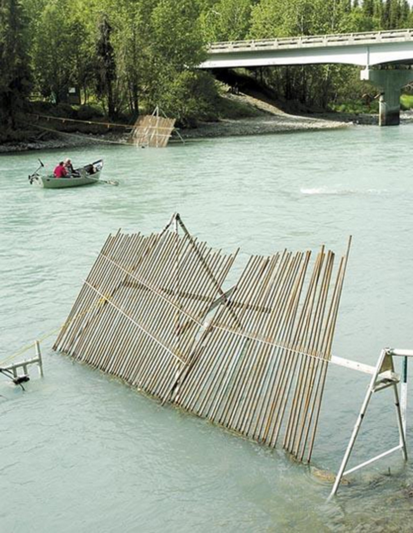
Drift boat fishers pass the sonar station at its location just upstream from the Sterling Highway bridge on the Kasilof River. -Peninsula Clarion file photo

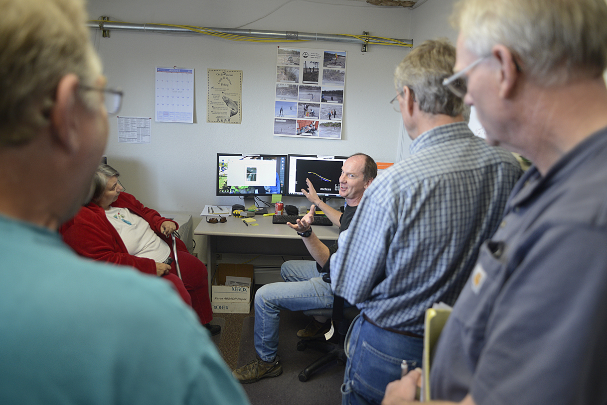
Research biologist Jim Miller chats with a group about the Alaska Department of Fish and Game’s sonar projects on the Kenai River on Aug. 15 in Kenai. Several in the group had questions about the accuracy of the department’s chinook salmon measuring programs on the Kenai River.-Photo by Rashah McChesney, Morris News Service – Alaska
